Following snowy tracks
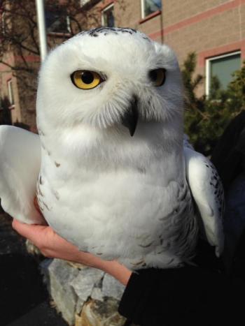
As we slide into spring, it seems odd to be writing about winter birds, but in truth most of our birds of winter are still around. That’s true even of snowy owls, as we have found by checking Project SNOWstorm maps. Project SNOWstorm is a remarkable research effort that captures snowy owls at airports, where they are considered an aviation risk, and affixes solar-powered satellite transmitters to them after relocating them far away, safely from the airport.
One of the coolest things about the technology that the researchers are using in Project SNOWstorm is that the transmitters send in location data via the cell phone tower network. Other satellite tagging technologies only send in locations every few days or sometimes not until a bird is recaptured. The cell phone transmitter technology used in Project SNOWstorm identifies the location of the snowy owls every few minutes! There is, of course, a caveat. If the bird moves outside of the range of any cell towers, then the location data cannot be transmitted and that particular bird’s location becomes a mystery until it once again comes within range of a cell tower. At that point, all the location data from the time it last was within range of a cell tower is downloaded.
Last spring, one of the marked snowy owls disappeared from the network and did not reappear again until February, when all of its movements over the previous 10 months or so were sent via the cell phone network to the researchers. They discovered that the bird had flown north last spring to a point above the Arctic circle and then had eventually made its way back south again into southern Canada where its transmitter starting sending signals to the cell towers that came within range.
Several snowy owls were tagged in Maine this year through Project SNOWstorm. One of these, an adult female, was captured at the Brunswick Executive Airport in January and relocated down to Rachel Carson National Wildlife Refuge in Wells. Nicknamed “Brunswick,” she made her way south into New Hampshire and the north coast of Massachusetts before eventually settling on the islands of the Isle of Shoals off of Portsmouth, New Hampshire, and Kittery, Maine, where she remained as of March 24th. Another snowy owl, this one nicknamed “Casco,” was captured at the Portland International Airport in late February, tagged, and then released way down in Washington County, Maine, in some extensive blueberry barrens. She made a surprising circular trip of more than 500 miles, first heading north through New Brunswick into Quebec, then flying west across northern Maine and into Quebec again. After spending time in some farmland in Quebec, Casco went south through Vermont and New Hampshire, then flying to the Plum Island area of Massachusetts! She was still there of late March. Another female snowy owl (this one nicknamed “Merrimack”) was captured at Logan Airport in Boston on March 8th. She headed north as far as Sebago Lake, where she spent a few days before moving south again, hanging around the beaches of Scarborough as of March 24th.
You can find out where Brunswick, Casco, and Merrimack are now by checking the maps on the Project SNOWstorm website (www.projectsnowstorm.org). There you can also find blog updates, learn more about the project, and even contribute to crowd-source funding to buy transmitters and support this exciting initiative.


.png)
.png)

